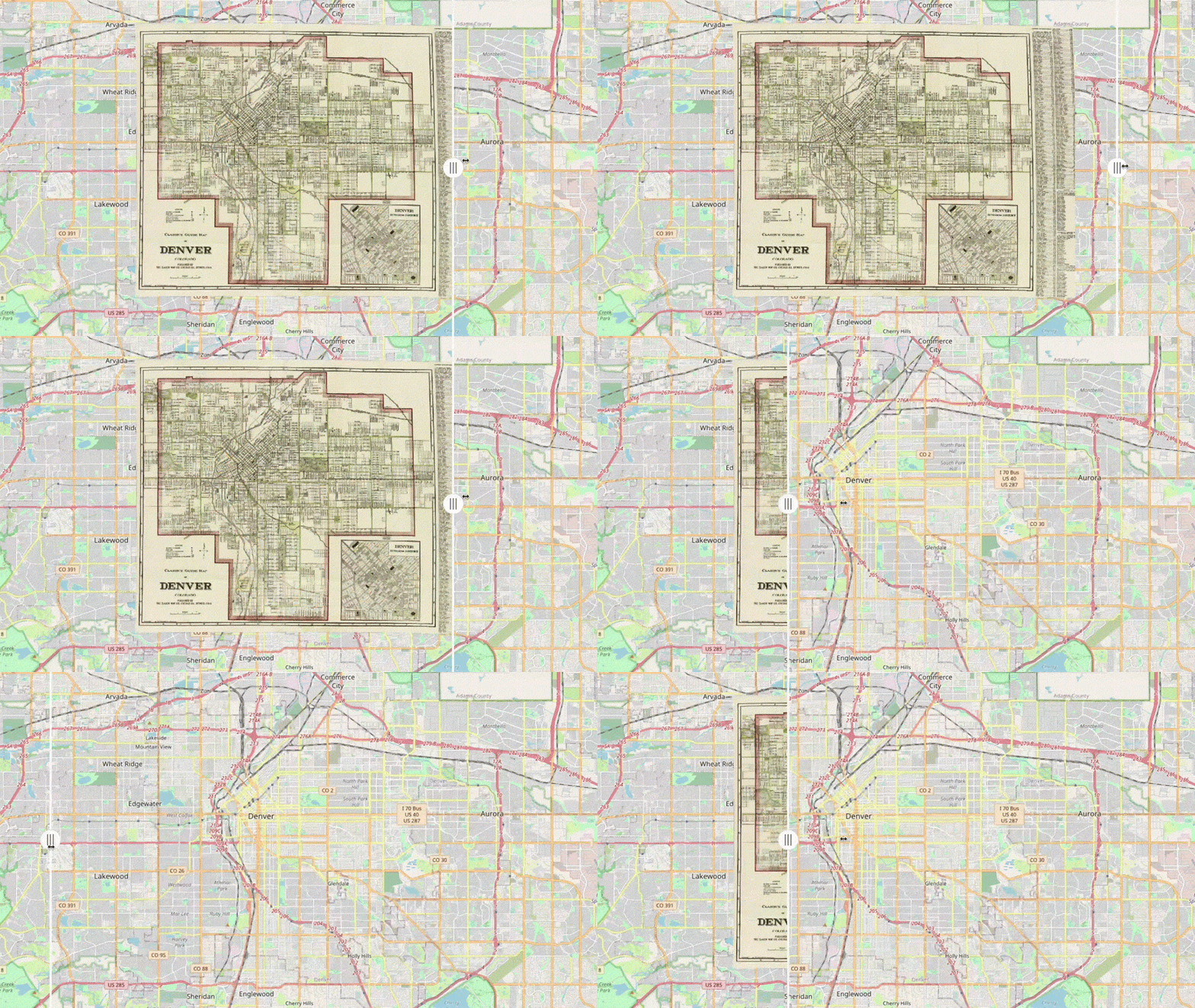
Heads up, carto-geeks, Denver Public Library has a new rabbit hole for you. They call it the "Time Traveler's Map of Denver," and it may well absorb your morning, says map and geospatial librarian Craig Haggit.
"Make sure you carve out three hours of your time," he told us, "because you get lost in this thing."
DPL has long held some pretty detailed and revealing historic maps. This Time Traveler's edition is a compilation of some of their greatest hits, with a new feature: the diagrams have been geo-referenced and placed correctly over a 2022 Google map of the city, allowing you to directly compare the city of today to the city of 1878, 1933, 1965 and more.
This experience, Haggit said, can be more insightful than pulling these physical documents from DPL's collection.
"It sort of makes apples to apples whereas, if you have two maps side by side, it's like apples to oranges - you just can't compare them as well," he told us with glee. "It just changes the way you can experience the city."
The Time Traveler's Map was produced by Dennis McCarthy, a retired software engineer who worked on similar projects for Boston's public library system. He moved to Denver a few years ago to be closer to his grandchildren.
"For me, the maps aren't an end in of itself. It's a tool, for me, to view history," he told us.
Here are some cool things we saw in our own dive into the rabbit hole:
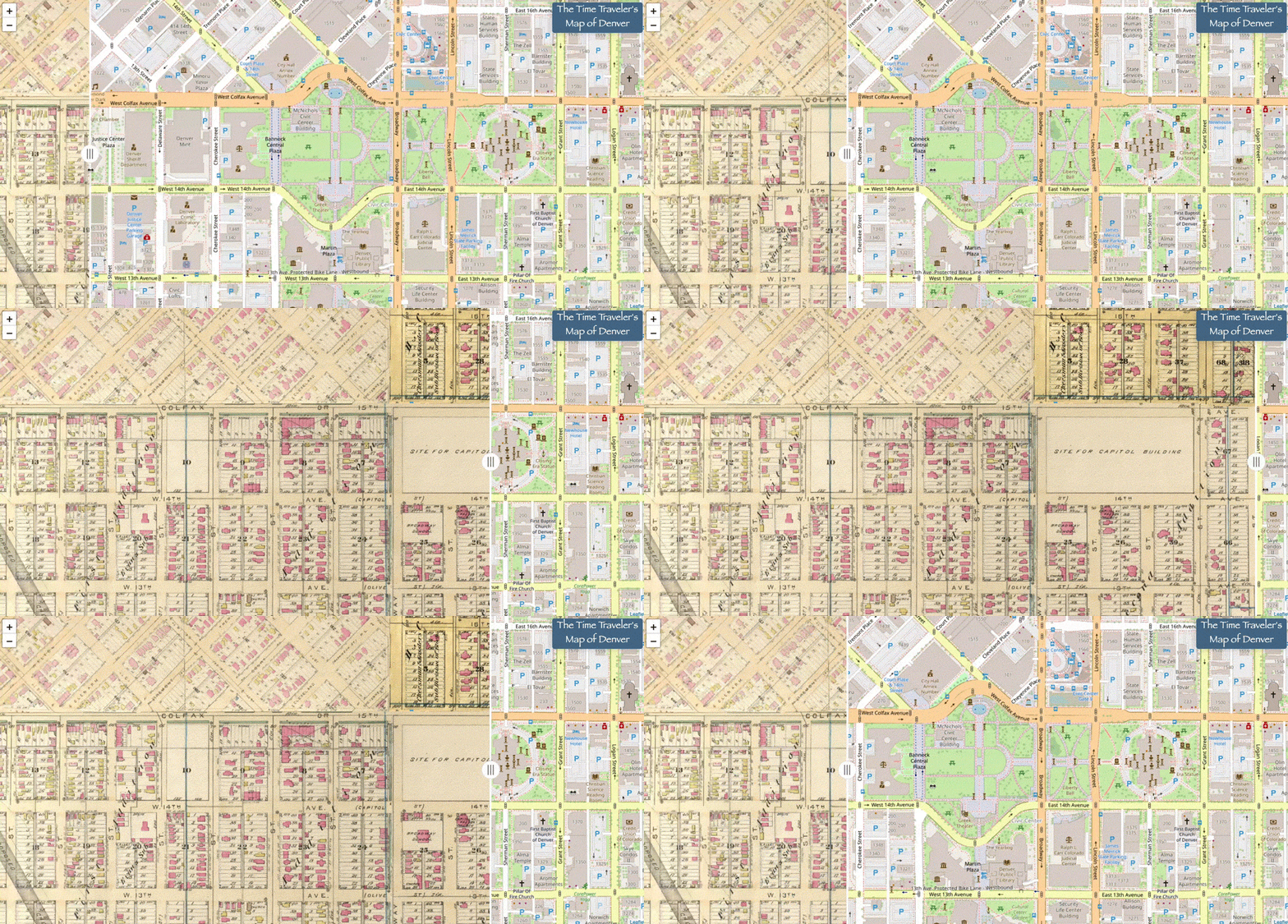
Civic Center Park was once a dense neighborhood, and you can see it in the map's 1887 Robinson Atlas layer.
The civic complex was constructed in the early 1900s and was famously a project of Mayor Robert Speer, who latched on to a national attraction to the "City Beautiful" architectural movement born during the 1893 World's Fair in Chicago. In 1905, city officials hired Charles Mulford Robinson - a muckraking journalist-turned urban planner - to conceive of a new center for their growing city.
The library does have some photos of the homes that pre-dated the complex, but there hasn't been much recent ink spilled about the project's impact on residents. Civic Center's official write-up for the National Register of Historic Places mentions them in passing, saying Robinson deemed existing architecture in the area as "unremarkable."
Robinson "saw the land between these points as an appropriate area for demolishing existing structures, creating sight-lines, and establishing new park areas with tree-lined walkways and a basin with a water jet," according to the document.
Source: Denver Public Library's Time Traveler's Map of Denver
There may not be many stories left circulating about people displaced by Civic Center Park, but there are plenty about those displaced by the Auraria Campus.
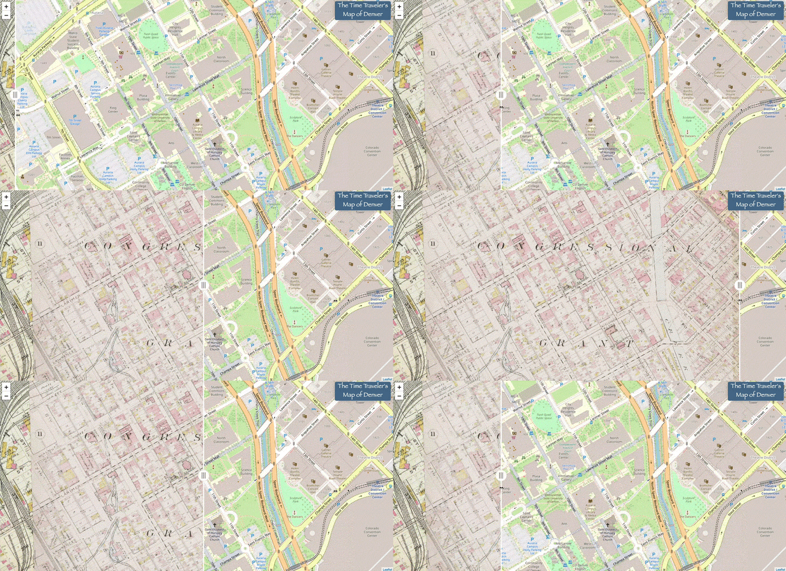
In the 1960s, the campus replaced a dense neighborhood made up largely of Hispanic and working class residents. Today, the city has mostyl acknowledged that the area's demolition was a traumatic moment for a generation of Denverites. Descendants of former residents can now attend the campus' institutions for free, and the area's cultural history is a regular topic of research and discussion.
The Time Traveler's map shows the neighborhood's transformation.
Source: Denver Public Library's Time Traveler's Map of Denver
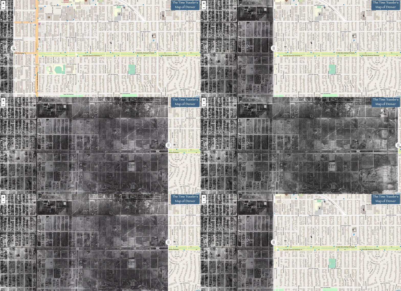
Every now and then, we hear from people who remember when our neighborhoods, long-established and seemingly ever-present, were once just pastures.
DPL's 1933 King Aerial Survey of Denver shows that history in start resolution. This map is a compilation of 100 photographs, captured on glass plate negatives, that covered the core of Denver's modern footprint.
Here's a look at the 6th Avenue Parkway, stretching east from Colorado Boulevard.
Source: Denver Public Library's Time Traveler's Map of Denver
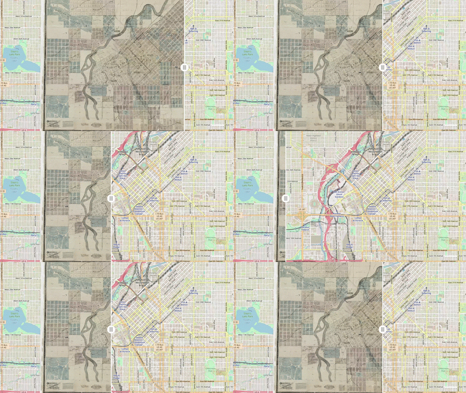
There are some variations of the South Platte River's shape in these documents, like this depiction from 1878 that shows the waterway gnarling and twisting through town.
Haggit, the library's geography guy, said there are plenty of maps in the library's collection that aren't quite right, so this historic depiction of the South Platte could be flawed.
Still, it's interesting because rivers usually do shift their paths over time, and Denver has a history of fighting with the river that flows through its core. Flooding was a major and recurring problem throughout the city's history. Conflicts with its destructive potential came to a head in the 1960s, after Denverites had turned the waterway into a garbage dump and their densifying numbers were hit hard by a biblical rush of water. The city began a campaign to clean up the South Platte's banks afterwards, and flood control became a subject of discussion and investment - it still is today.
Source: Denver Public Library's Time Traveler's Map of Denver
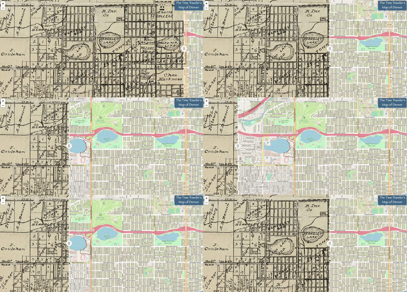
You have to go back pretty far for this one, but you can see Lakeside before there was a Lakeside.
A later map layer shows an annotation scrawled across the street from Berkeley Lake, proclaiming the amusement park's presence, "the white city."
Lakeside, like Civic Center Park, was progeny of the Chicago World's Fair of 1893, where a temporary city was built and also called the "white city." But while there isn't much left of the Chicago version, the Denver amusement park is still alive and kicking. On another dive into DPL's history collection, we found a whole bunch of images of the place through the years.
Source: Denver Public Library's Time Traveler's Map of Denver
You can check out DPL's Time Traveler's Map here. Email us at [email protected] if you find something cool!
 Thanks for the support, Denverites!
